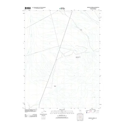
2011 Map of Redrock Spring
USGS Topo · Published 2011About this map
The Mountain Springs Mining Area anchors this 2011 survey of Lander County, Nevada, where industrial access via McCoy Mine Rd intersects the arid terrain. The landscape is defined by its critical water sources, including Mound Springs and Redrock Spring, which provide essential moisture in a region characterized by deep cuts like Harry Canyon and Redrock Canyon. The presence of Harry Canyon Spring Number One indicates the importance of specific, named water points for both historical mining operations and local ranching. While the Reese River and Mill Creek show the drainage patterns of the valley, the infrastructure is clearly geared toward the extraction and transport needs of the mountain mining sites.
Find a feature on this map
10 named features on this map. Tap any name to fly to it.
Don’t see what you’re looking for? This feature index may not catch every label — zoom into the map to look around manually.
Map Details
Editions of this 2011 Redrock Spring Map
This is the sole edition of this map. No revisions or reprints were ever made.
Other maps of this area

1932 · Sonoma Range
USGS Topo · 1:250,000

1939 · Sonoma Range
USGS Topo · 1:250,000

1949 · Mt. Lewis
USGS Topo · 1:62,500

1950 · Mt. Lewis
USGS Topo · 1:62,500

1955 · Winnemucca
USGS Topo · 1:250,000

1958 · Winnemucca
USGS Topo · 1:250,000

1961 · McCoy
USGS Topo · 1:62,500

1961 · The Cedars
USGS Topo · 1:62,500

1962 · Winnemucca
USGS Topo · 1:250,000

1962 · Carico Lake
USGS Topo · 1:62,500