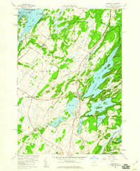
1958 Map of Redwood
USGS Topo · Published 1960About this map
The St Lawrence River and its intricate shoreline define the northwestern edge of this Jefferson County landscape, where Kring Point State Park juts into the water near a cluster of named islands including Wintergreen Island and Caprice Island. Inland, the terrain is characterized by a dense network of lakes and marshes, with Butterfield Lake and Millsite Lake dominating the eastern half. The village of Redwood serves as a central hub, situated near Mud Lake at a junction where the New York Central railroad once threaded through the lake country.
Find a feature on this map
64 named features on this map. Tap any name to fly to it.
Don’t see what you’re looking for? This feature index may not catch every label — zoom into the map to look around manually.
Map Details
Editions of this 1958 Redwood Map
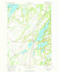
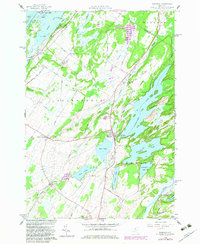
3 editions found
Other maps of this area

1903 · Alexandria Bay
USGS Topo · 1:62,500

1903 · Theresa
USGS Topo · 1:62,500

1911 · Antwerp
USGS Topo · 1:62,500

1912 · Hammond
USGS Topo · 1:62,500

1943 · Redwood
USGS Topo · 1:31,680

1943 · Lafargeville
USGS Topo · 1:31,680

1943 · Alexandria Bay
USGS Topo · 1:31,680

1944 · Hammond
USGS Topo · 1:62,500

1948 · Theresa
USGS Topo · 1:24,000

1948 · Chippewa Bay
USGS Topo · 1:24,000