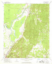
1962 Map of Redwood
USGS Topo · Published 1968About this map
The Indian Treaty Boundary cuts through the rugged hills of Warren County, where the landscape transitions sharply from the bluffs to the bottomlands of the Yazoo River. This 1962 survey illustrates the dense concentration of oxbow lakes—remnants of the river's changing course—including Goose Lake, Taylor Lake, and Horseshoe Lake. The Illinois Central railroad serves as the primary corridor for commerce and travel, connecting settlements like Redwood, Blakely, and Waltersville along the eastern edge of the floodplain. Local heritage is deeply etched into the topography through sites like the Site of Fort St Peter and numerous country churches, including St James Ch and Travis Chapel. To the south, the northern reaches of the Vicksburg National Military Park encompass the high ground overlooking Chickasaw Bayou, reflecting the area's strategic importance during the American Civil War.
Find a feature on this map
41 named features on this map. Tap any name to fly to it.
Don’t see what you’re looking for? This feature index may not catch every label — zoom into the map to look around manually.
Map Details
Editions of this 1962 Redwood Map
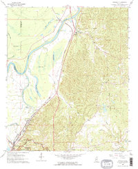
3 editions found
Other maps of this area

1918 · Vicksburg
USGS Topo · 1:62,500

1938 · Edwards
USGS Topo · 1:62,500

1939 · Onward
USGS Topo · 1:62,500

1940 · Mechanicsburg
USGS Topo · 1:62,500

1941 · Vicksburg
USGS Topo · 1:62,500

1955 · Jackson
USGS Topo · 1:250,000

1961 · Jackson
USGS Topo · 1:250,000

1962 · Jackson
USGS Topo · 1:250,000

1962 · Redwood
USGS Topo · 1:24,000

1962 · Vicksburg West
USGS Topo · 1:24,000