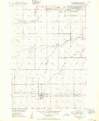
1950 Map of Ree Heights
USGS Topo · Published 1950About this map
Ree Heights serves as the primary hub of activity in this mid-century portrait of Hand County, anchored by the Chicago and North Western railroad corridor. The settlement is characterized by a grid of streets adjacent to the Morningside Cem, reflecting a period of established prairie life. Rural education is still decentralized at this time, evidenced by the presence of Steptoe Sch and Center Sch situated across the township lines.
Find a feature on this map
15 named features on this map. Tap any name to fly to it.
Don’t see what you’re looking for? This feature index may not catch every label — zoom into the map to look around manually.
Map Details
Editions of this 1950 Ree Heights Map
2 editions found
Other maps of this area

1949 · Ree Heights NW
USGS Topo · 1:24,000

1950 · Ree Heights SE
USGS Topo · 1:24,000

1950 · Highmore NE
USGS Topo · 1:24,000

1950 · Ree Heights
USGS Topo · 1:24,000

1950 · Highmore SE
USGS Topo · 1:24,000

1951 · Ree Heights NW
USGS Topo · 1:24,000

1951 · Ree Heights NE
USGS Topo · 1:24,000

1953 · Huron
USGS Topo · 1:250,000

1954 · Huron
USGS Topo · 1:250,000

1973 · Macs Corner NE
USGS Topo · 1:24,000