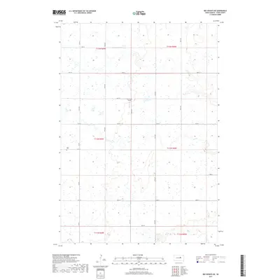
2017 Map of Ree Heights NE
USGS Topo · Published 2017About this map
The prairie landscape of Hand County is defined by the winding course of Lost Creek and its southern tributaries. This rural expanse, surveyed in the modern era, retains a strictly gridded layout of section lines and secondary roads such as Co Rd 4 and 187th St. Genealogy and local history are anchored by the Alden Cem, located in the western portion of the quadrangle. The agricultural and aviation history of the region is represented by the Lost Creek Airport, a small facility situated near the junction of 185th St and 356th Ave. The terrain is marked by numerous small depressions and wetlands, characteristic of the local drainage patterns near Wolf Cr in the south. The map provides a precise view of rural infrastructure, including township boundaries and the systematic road network that serves this part of South Dakota.
Find a feature on this map
25 named features on this map. Tap any name to fly to it.
Don’t see what you’re looking for? This feature index may not catch every label — zoom into the map to look around manually.
Map Details
Editions of this 2017 Ree Heights NE Map
This is the sole edition of this map. No revisions or reprints were ever made.
Other maps of this area

1899 · Redfield
USGS Topo · 1:125,000

1949 · Ree Heights NW
USGS Topo · 1:24,000

1950 · Ree Heights SE
USGS Topo · 1:24,000

1950 · Ree Heights
USGS Topo · 1:24,000

1951 · Ree Heights NW
USGS Topo · 1:24,000

1951 · Orient SW
USGS Topo · 1:24,000

1951 · Polo
USGS Topo · 1:24,000

1951 · Ree Heights NE
USGS Topo · 1:24,000

1953 · Huron
USGS Topo · 1:250,000

1954 · Huron
USGS Topo · 1:250,000