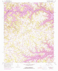
1960 Map of Reed Creek
USGS Topo · Published 1975About this map
Lake Hartwell dominates the landscape along the Tugaloo River, where the borders of Georgia and South Carolina meet. This early 1960s survey documents the rural character of Hart County before extensive modern lakeside development took hold. Small agricultural communities like Reed Creek and Maretts serve as the primary hubs, connected by a network of rural roads and a solitary Landing Strip near the reservoir. The map is particularly dense with community landmarks such as New Hope Ch, Mount Hebron Ch, and Sharon Ch, alongside family-named burial grounds including Byrum Cem and McMullan Cem. These sites, along with drainage features like Little Lightwood Creek and Beaverdam Creek, provide a clear picture of the region's traditional settlement patterns during the mid-century era.
Find a feature on this map
31 named features on this map. Tap any name to fly to it.
Don’t see what you’re looking for? This feature index may not catch every label — zoom into the map to look around manually.
Map Details
Editions of this 1960 Reed Creek Map
Other maps of this area

1886 · Walhalla
USGS Topo · 1:125,000

1888 · Pickens
USGS Topo · 1:125,000

1891 · Carnesville
USGS Topo · 1:125,000

1892 · Walhalla
USGS Topo · 1:125,000

1893 · Elberton
USGS Topo · 1:125,000

1894 · Pickens
USGS Topo · 1:125,000

1896 · Walhalla
USGS Topo · 1:125,000

1950 · La France
USGS Topo · 1:24,000

1951 · La France
USGS Topo · 1:24,000

1954 · Greenville
USGS Topo · 1:250,000