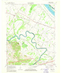
1971 Map of Reed
USGS Topo · Published 1973About this map
The Green River winds in deep meanders across this northern Kentucky landscape, defining the boundary between Henderson and Daviess counties. Along its northern banks, the Louisville and Nashville Road connects the small settlements of Reed and Newman, passing through an area dense with local infrastructure such as St Peters Sch and Mt Zion Ch. To the south, the terrain transitions into the protected wetlands of the Sloughs Wildlife Management Area, highlighting the region's reliance on natural floodplains and sloughs like Richland Slough and Birk City Slough.
Find a feature on this map
42 named features on this map. Tap any name to fly to it.
Don’t see what you’re looking for? This feature index may not catch every label — zoom into the map to look around manually.
Map Details
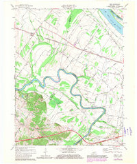
Editions of this 1971 Reed Map
2 editions found
Other maps of this area

1901 · Owensboro
USGS Topo · 1:62,500

1905 · Newburg
USGS Topo · 1:62,500

1906 · Sutherland
USGS Topo · 1:62,500

1908 · Calhoun
USGS Topo · 1:62,500

1951 · Yankeetown
USGS Topo · 1:24,000

1951 · Spottsville
USGS Topo · 1:24,000

1952 · Owensboro West
USGS Topo · 1:24,000

1952 · Newburgh
USGS Topo · 1:24,000

1952 · Reed
USGS Topo · 1:24,000
1953 · Delaware
USGS Topo · 1:24,000