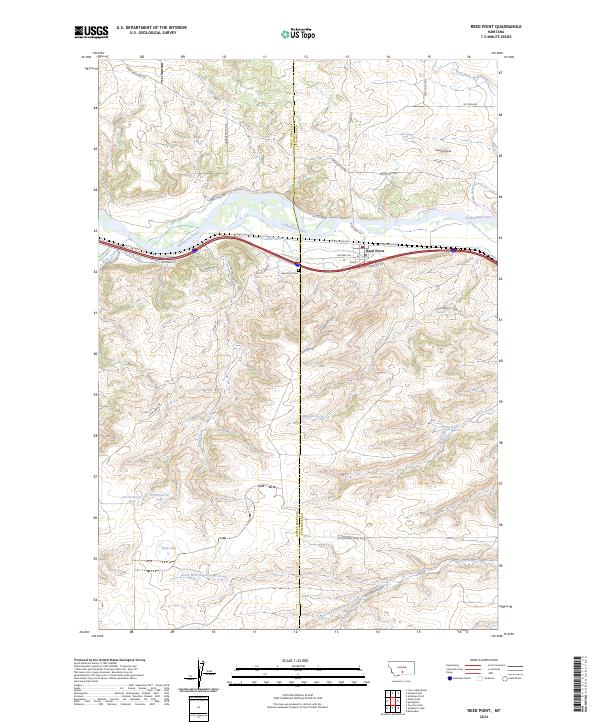
2024 Map of Reed Point
USGS Topo · Published 2024About this map
Reed Point serves as the primary hub along the northern bank of the Yellowstone River, positioned where the landscape transitions from river valley to the higher, coulee-cut plains. This area is defined by its water management systems, including the Reed Point Ditch and Kent Ditch, which parallel the river and highlight the historical importance of irrigation in the local agricultural economy. The county boundary between Sweet Grass Co and Stillwater Co bisects the region, running south toward Countryman Creek and its various forks.
Find a feature on this map
45 named features on this map. Tap any name to fly to it.
Don’t see what you’re looking for? This feature index may not catch every label — zoom into the map to look around manually.
Map Details
Editions of this 2024 Reed Point Map
This is the sole edition of this map. No revisions or reprints were ever made.
Other maps of this area

1891 · Big Timber
USGS Topo · 1:125,000

1892 · Stillwater
USGS Topo · 1:125,000

1893 · Big Timber
USGS Topo · 1:125,000

1954 · Billings
USGS Topo · 1:250,000

1955 · Antelope Point
USGS Topo · 1:24,000

1955 · Sandborn Creek
USGS Topo · 1:24,000

1955 · Reed Point
USGS Topo · 1:24,000

1955 · Springtime
USGS Topo · 1:24,000

1955 · Absarokee
USGS Topo · 1:24,000
1955 · Cow Face Hill
USGS Topo · 1:24,000