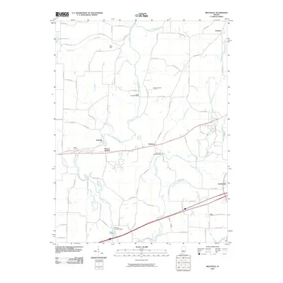
2010 Map of Reelsville
USGS Topo · Published 2010About this map
Big Walnut Creek carves a winding path through this corner of Putnam County, defining a landscape marked by its historic river crossings. The map highlights three distinct timber structures — the Houck Covered Bridge, Manhatten Covered Bridge, and Huffman Covered Bridge — which stand as architectural landmarks along the waterways. These bridges once served as vital links for the scattered communities of Reelsville, Manhattan, and Pleasant Gardens, where the early 21st-century road network still follows the legacy of these traditional transit points.
Find a feature on this map
74 named features on this map. Tap any name to fly to it.
Don’t see what you’re looking for? This feature index may not catch every label — zoom into the map to look around manually.
Map Details
Editions of this 2010 Reelsville Map
This is the sole edition of this map. No revisions or reprints were ever made.
Other maps of this area

1908 · Clay City
USGS Topo · 1:48,000

1910 · Clay City
USGS Topo · 1:62,500

1950 · Brazil East
USGS Topo · 1:24,000

1951 · Clinton Falls
USGS Topo · 1:24,000

1951 · Mansfield
USGS Topo · 1:24,000

1952 · Reelsville
USGS Topo · 1:24,000

1953 · Indianapolis
USGS Topo · 1:250,000

1956 · Indianapolis
USGS Topo · 1:250,000

1956 · Cloverdale
USGS Topo · 1:24,000

1956 · Cataract
USGS Topo · 1:24,000