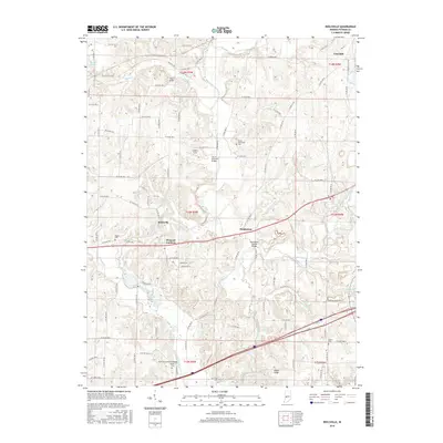
2016 Map of Reelsville
USGS Topo · Published 2016About this map
Big Walnut Creek meanders through the heart of this Putnam County landscape, defining the character of small communities like Reelsville and Manhattan. This 2016 survey illustrates a region where transportation history is deeply embedded in the terrain, evidenced by several historic crossings including the Houck Covered Bridge and the Manhattan Covered Bridge. The map shows a transition from the upland heights of Fern Cliff and Indian Ridge down to the fertile bottoms of Deer Creek and Leatherwood Cr. Genealogists will find notable value in the clearly marked burial grounds such as Boone-Hutcheson Cem and Salem Cem, which serve as quiet landmarks alongside the modern road network. The settlement at Pleasant Gardens and the industrial activity near Limedale further showcase the varied land use across this part of Indiana.
Find a feature on this map
86 named features on this map. Tap any name to fly to it.
Don’t see what you’re looking for? This feature index may not catch every label — zoom into the map to look around manually.
Map Details
Editions of this 2016 Reelsville Map
This is the sole edition of this map. No revisions or reprints were ever made.
Other maps of this area

1908 · Clay City
USGS Topo · 1:48,000

1910 · Clay City
USGS Topo · 1:62,500

1950 · Brazil East
USGS Topo · 1:24,000

1951 · Clinton Falls
USGS Topo · 1:24,000

1951 · Mansfield
USGS Topo · 1:24,000

1952 · Reelsville
USGS Topo · 1:24,000

1953 · Indianapolis
USGS Topo · 1:250,000

1956 · Indianapolis
USGS Topo · 1:250,000

1956 · Cloverdale
USGS Topo · 1:24,000

1956 · Cataract
USGS Topo · 1:24,000