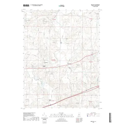
2019 Map of Reelsville
USGS Topo · Published 2019About this map
Big Walnut Creek and Deer Creek define the geography of this rural Indiana landscape, where historic architecture remains a central feature of the countryside. The area is notable for its concentration of structural landmarks, including the Houck Covered Bridge, the Manhattan Covered Bridge, and the Huffman Covered Bridge. These sites, along with the Fern Cliff terrain, highlight the intersection of natural waterways and early engineering. Local history is deeply embedded in the numerous burial grounds scattered across the townships, such as the Boone - Hutcheson Cem and Lower Boone Cem near the village of Reelsville. The settlement pattern follows the established corridors between Manhattan and Pleasant Gardens, providing a clear view of the region's agricultural and communal layout.
Find a feature on this map
57 named features on this map. Tap any name to fly to it.
Don’t see what you’re looking for? This feature index may not catch every label — zoom into the map to look around manually.
Map Details
Editions of this 2019 Reelsville Map
This is the sole edition of this map. No revisions or reprints were ever made.
Other maps of this area

1908 · Clay City
USGS Topo · 1:48,000

1910 · Clay City
USGS Topo · 1:62,500

1950 · Brazil East
USGS Topo · 1:24,000

1951 · Clinton Falls
USGS Topo · 1:24,000

1951 · Mansfield
USGS Topo · 1:24,000

1952 · Reelsville
USGS Topo · 1:24,000

1953 · Indianapolis
USGS Topo · 1:250,000

1956 · Indianapolis
USGS Topo · 1:250,000

1956 · Cloverdale
USGS Topo · 1:24,000

1956 · Cataract
USGS Topo · 1:24,000