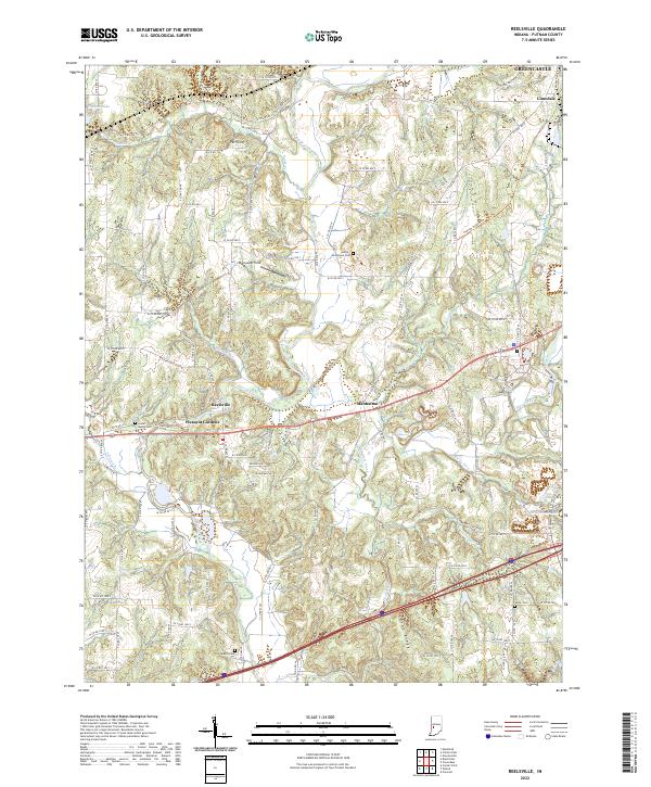
2022 Map of Reelsville
USGS Topo · Published 2022About this map
Big Walnut Creek winds through the heart of this Putnam County landscape, creating a deeply dissected terrain that defines the local geography. The area is anchored by several small settlements including Reelsville, Manhattan, and Pleasant Gardens, which sit along the primary east-west transportation corridors. This modern record illustrates how contemporary infrastructure, such as the dense network of county roads like W Co Rd 500 S, overlays the traditional agricultural and topographical patterns of the region.
Find a feature on this map
83 named features on this map. Tap any name to fly to it.
Don’t see what you’re looking for? This feature index may not catch every label — zoom into the map to look around manually.
Map Details
Editions of this 2022 Reelsville Map
This is the sole edition of this map. No revisions or reprints were ever made.
Other maps of this area

1908 · Clay City
USGS Topo · 1:48,000

1910 · Clay City
USGS Topo · 1:62,500

1950 · Brazil East
USGS Topo · 1:24,000

1951 · Clinton Falls
USGS Topo · 1:24,000

1951 · Mansfield
USGS Topo · 1:24,000

1952 · Reelsville
USGS Topo · 1:24,000

1953 · Indianapolis
USGS Topo · 1:250,000

1956 · Indianapolis
USGS Topo · 1:250,000

1956 · Cloverdale
USGS Topo · 1:24,000

1956 · Cataract
USGS Topo · 1:24,000