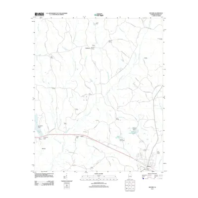
2011 Map of Reform
USGS Topo · Published 2011About this map
Reform serves as the primary hub in this portion of Pickens County, centered around the Reform Post Office and a grid of residential streets like 4th St NW and 3rd Ave SE. The surrounding landscape is defined by the heavy drainage of Coal Fire Creek and its many tributaries, such as Chicken Swamp Branch and Little Coal Fire Creek. This area reveals a transition from traditional rural settlements to modern resource extraction, evidenced by the presence of the Coal Fire Creek Gas Field and Board Tree Branch Gas Field.
Find a feature on this map
85 named features on this map. Tap any name to fly to it.
Don’t see what you’re looking for? This feature index may not catch every label — zoom into the map to look around manually.
Map Details
Editions of this 2011 Reform Map
This is the sole edition of this map. No revisions or reprints were ever made.
Other maps of this area

1953 · Birmingham
USGS Topo · 1:250,000

1953 · West Point
USGS Topo · 1:250,000

1956 · Birmingham
USGS Topo · 1:250,000

1957 · Birmingham
USGS Topo · 1:250,000

1958 · West Point
USGS Topo · 1:250,000

1963 · West Point
USGS Topo · 1:250,000

1966 · Ethelsville
USGS Topo · 1:24,000

1966 · Reform SW
USGS Topo · 1:24,000

1967 · Carrollton
USGS Topo · 1:24,000

1967 · Kennedy
USGS Topo · 1:24,000