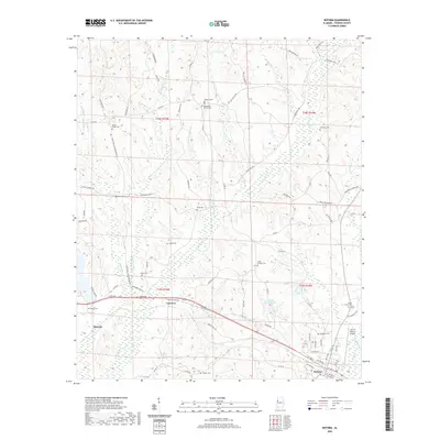
2020 Map of Reform
USGS Topo · Published 2020About this map
Reform and its surrounding Pickens County landscape are defined by a network of creeks and branches that drain into the Coal Fire Ck valley. The settlement pattern here is characterized by scattered rural communities like Coal Fire and Melrose, where local history is anchored by numerous family and community burial grounds, including Bethlehem Cem, Hamilton Cem, and Arbor Springs Cem. Religious life centers on the Bethlehem Church, while the North Pickens Airport provides a modern aviation anchor near the city limits.
Find a feature on this map
82 named features on this map. Tap any name to fly to it.
Don’t see what you’re looking for? This feature index may not catch every label — zoom into the map to look around manually.
Map Details
Editions of this 2020 Reform Map
This is the sole edition of this map. No revisions or reprints were ever made.
Other maps of this area

1953 · Birmingham
USGS Topo · 1:250,000

1953 · West Point
USGS Topo · 1:250,000

1956 · Birmingham
USGS Topo · 1:250,000

1957 · Birmingham
USGS Topo · 1:250,000

1958 · West Point
USGS Topo · 1:250,000

1963 · West Point
USGS Topo · 1:250,000

1966 · Ethelsville
USGS Topo · 1:24,000

1966 · Reform SW
USGS Topo · 1:24,000

1967 · Carrollton
USGS Topo · 1:24,000

1967 · Kennedy
USGS Topo · 1:24,000