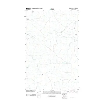
2011 Map of Regal Coulee
USGS Topo · Published 2011About this map
The Larb Hills rise above a landscape defined by an intricate network of drainages in this 2011 topographic survey of Phillips County. This remote section of Montana is characterized by its named coulees and water sources, such as Regal Springs and the Converse Reservoir, which suggest the vital importance of water management for cattle ranching in the region. The D K Ranch serves as a primary human landmark amidst the rugged topography of Regal Coulee and Thomas Coulee.
Find a feature on this map
15 named features on this map. Tap any name to fly to it.
Don’t see what you’re looking for? This feature index may not catch every label — zoom into the map to look around manually.
Map Details
Editions of this 2011 Regal Coulee Map
This is the sole edition of this map. No revisions or reprints were ever made.
Other maps of this area

1905 · Bowdoin
USGS Topo · 1:62,500

1905 · Saco Special
USGS Topo · 1:62,500

1954 · Glasgow
USGS Topo · 1:250,000

1957 · Glasgow
USGS Topo · 1:250,000

1958 · Glasgow
USGS Topo · 1:250,000

1984 · Pinks
USGS Topo · 1:24,000
1984 · Robinson Ranch
USGS Topo · 1:24,000

1984 · Harb
USGS Topo · 1:24,000
1984 · Bowdoin
USGS Topo · 1:24,000
1984 · Saco
USGS Topo · 1:24,000