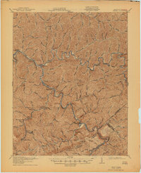
1917 Map of Regina
USGS Topo · Published 1945About this map
Levisa Fork and Russell Fork carve deep paths through the steep terrain of Pike County, meeting at The Forks Millard P O. This early 20th-century landscape is defined by its post-office settlements and the industrial expansion of the Allegheny Mine near Hellier. The rail networks of the Chesapeake and Ohio and Carolina Clinchfield and Ohio navigate the narrow valleys, connecting mountain coal operations to broader markets. High ridges like Pine Mountain and Ripley Knob separate isolated communities such as Marrowbone Regina P O and Shelby Shelliana P O, illustrating the complex social and economic geography of the Kentucky and Virginia borderlands. The intricate drainage patterns of Pond Creek and Elkhorn Creek reflect a region where every hollow and branch supported early family settlements and resource extraction.
Find a feature on this map
48 named features on this map. Tap any name to fly to it.
Don’t see what you’re looking for? This feature index may not catch every label — zoom into the map to look around manually.
Map Details
Editions of this 1917 Regina Map
3 editions found
Other maps of this area

1886 · Prestonsburg
USGS Topo · 1:125,000

1886 · Grundy
USGS Topo · 1:125,000

1887 · Warfield
USGS Topo · 1:125,000

1890 · Whitesburg
USGS Topo · 1:125,000

1890 · Grundy
USGS Topo · 1:125,000

1891 · Warfield
USGS Topo · 1:125,000

1892 · Grundy
USGS Topo · 1:125,000

1892 · Whitesburg
USGS Topo · 1:125,000

1892 · Prestonsburg
USGS Topo · 1:125,000

1909 · Matewan
USGS Topo · 1:48,000