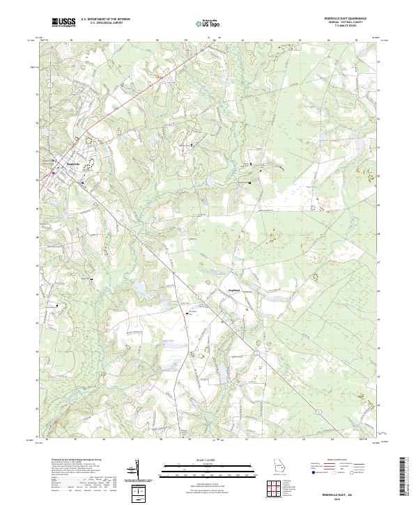
2024 Map of Reidsville East
USGS Topo · Published 2024About this map
The city of Reidsville serves as the focal point for this Tattnall County landscape, where the Tattnall County Judicial Annex and local streets like Southside Dr give way to a pastoral network of family-named roads and burial grounds. To the east, the small settlement of Hughland sits near the intersection of Co Rd 240 and Enoch Bradley Rd, anchoring a rural corridor defined by agriculture and local history. The terrain is marked by numerous family cemeteries, including the Old Shiloh Cem, Smith Cem, and Shady Grove Cem, which offer significant value for genealogists tracing regional lineages.
Find a feature on this map
136 named features on this map. Tap any name to fly to it.
Don’t see what you’re looking for? This feature index may not catch every label — zoom into the map to look around manually.
Map Details
Editions of this 2024 Reidsville East Map
This is the sole edition of this map. No revisions or reprints were ever made.
Other maps of this area

1919 · Claxton
USGS Topo · 1:62,500

1920 · Glennville
USGS Topo · 1:62,500

1944 · Claxton
USGS Topo · 1:62,500

1944 · Glennville
USGS Topo · 1:62,500

1946 · Brunswick
USGS Topo · 1:250,000

1947 · Savannah
USGS Topo · 1:250,000

1948 · Brunswick
USGS Topo · 1:250,000

1948 · Savannah
USGS Topo · 1:250,000

1950 · Glennville
USGS Topo · 1:62,500

1950 · Claxton
USGS Topo · 1:62,500