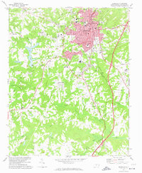
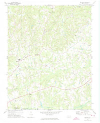
1972 Map of Reidsville
USGS Topo · Published 1974About this map
The industrial and civic hub of Reidsville dominates this portion of Rockingham County in the early 1970s, showing a well-established urban grid surrounded by agricultural lands. Educational and medical infrastructure is prominent, with the Penn Memorial Hospital and numerous neighborhood institutions like the Lawsonville Ave Sch and North End Sch serving the local population. The Southern railroad line runs through the heart of the city, emphasizing the area's history as a transportation center. Outside the city center, the landscape transitions to smaller settlements and rural landmarks, including Monroeton and Norwood. Water features such as Lake Hunt and the Haw River provided recreational and industrial resources, while local faith communities are well-documented through sites like Wesley Chapel and the Danbury Ch. This record captures a snapshot of a North Carolina textile and tobacco community before modern highway expansions significantly altered the outskirts.
Find a feature on this map
51 named features on this map. Tap any name to fly to it.
Don’t see what you’re looking for? This feature index may not catch every label — zoom into the map to look around manually.
Map Details
Editions of this 1972 Reidsville Map
2 editions found
Other maps of this area

1951 · Lake Brandt
USGS Topo · 1:24,000

1951 · Browns Summit
USGS Topo · 1:24,000

1953 · Greensboro
USGS Topo · 1:250,000

1954 · Greensboro
USGS Topo · 1:250,000

1962 · Greensboro
USGS Topo · 1:250,000

1966 · Greensboro
USGS Topo · 1:250,000

1970 · Ossipee
USGS Topo · 1:24,000
1971 · Southeast Eden
USGS Topo · 1:24,000
1971 · Ruffin
USGS Topo · 1:24,000
1971 · Bethany
USGS Topo · 1:24,000