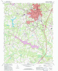
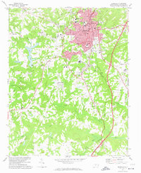
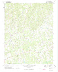
1972 Map of Reidsville
USGS Topo · Published 1994About this map
Reidsville anchors this 1970s landscape, serving as a hub for both industry and residential expansion in Rockingham County. The city center is densely mapped with local institutions, from the Middle Sch and Armory to Penn Memorial Hospital. Surrounding the urban core, the terrain is defined by a network of drainage basins, including Wolf Island Creek to the north and the Haw River crossing the southern reaches. The 1994 revision highlights significant modern development, including the expansion of Lake Reidsville, which dramatically altered the local hydrology. This transition from rural farmsteads to more structured suburban and recreational spaces is visible in the emergence of neighborhoods like Forest Hills and Norwood. For those tracing local families, the map preserves the locations of several smaller communities and landmarks, such as Sandy Cross, Monroeton, and numerous country churches including Wesley Chapel and Mizpah Ch.
Find a feature on this map
44 named features on this map. Tap any name to fly to it.
Don’t see what you’re looking for? This feature index may not catch every label — zoom into the map to look around manually.
Map Details
Editions of this 1972 Reidsville Map
2 editions found
Other maps of this area

1951 · Lake Brandt
USGS Topo · 1:24,000

1951 · Browns Summit
USGS Topo · 1:24,000

1953 · Greensboro
USGS Topo · 1:250,000

1954 · Greensboro
USGS Topo · 1:250,000

1962 · Greensboro
USGS Topo · 1:250,000

1966 · Greensboro
USGS Topo · 1:250,000

1970 · Ossipee
USGS Topo · 1:24,000
1971 · Southeast Eden
USGS Topo · 1:24,000
1971 · Ruffin
USGS Topo · 1:24,000
1971 · Bethany
USGS Topo · 1:24,000