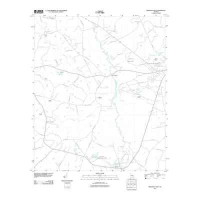
2011 Map of Reidsville West
USGS Topo · Published 2011About this map
The Ohoopee River carves a winding path through this corner of Tattnall County, defining the drainage patterns for numerous tributaries like Watson Creek, Rocky Creek, and Slaughter Creek. This early 21st-century landscape is characterized by a high density of small impoundments and ponds, many named for local families or landmarks, such as Wardins Cabin Pond and Chicken Yard Pond. These water features, managed by structures like the Wardens Cabin Pond Dam, reflect a history of private water management and agricultural utility in rural Georgia.
Find a feature on this map
77 named features on this map. Tap any name to fly to it.
Don’t see what you’re looking for? This feature index may not catch every label — zoom into the map to look around manually.
Map Details
Editions of this 2011 Reidsville West Map
This is the sole edition of this map. No revisions or reprints were ever made.
Other maps of this area

1953 · Waycross
USGS Topo · 1:250,000

1957 · Macon
USGS Topo · 1:250,000

1958 · Macon
USGS Topo · 1:250,000

1958 · Waycross
USGS Topo · 1:250,000

1964 · Macon
USGS Topo · 1:250,000
1970 · Collins
USGS Topo · 1:24,000

1970 · Johnson Corner
USGS Topo · 1:24,000

1970 · Ohoopee
USGS Topo · 1:24,000

1970 · Reidsville West
USGS Topo · 1:24,000

1970 · Lyons
USGS Topo · 1:24,000