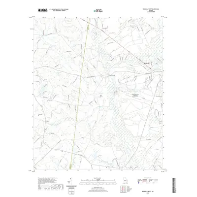
2020 Map of Reidsville West
USGS Topo · Published 2020About this map
Reidsville occupies the northeastern corner of this Tattnall County landscape, where the Ohoopee River and its numerous tributaries like Brazells Cr and Watson Cr create a complex system of wetlands and meandering waterways. The map documents a rural environment defined by family-named landmarks and historical crossings, such as Shepards Bridge and the Stanley Ford Bridge over Rocky Cr. Genealogists will find significant value in the distribution of local burial grounds, including Cave Cem, Stanley Cem, Ogden Mill Cem, and Ryals Cem, which are scattered throughout the countryside.
Find a feature on this map
125 named features on this map. Tap any name to fly to it.
Don’t see what you’re looking for? This feature index may not catch every label — zoom into the map to look around manually.
Map Details
Editions of this 2020 Reidsville West Map
This is the sole edition of this map. No revisions or reprints were ever made.
Other maps of this area

1953 · Waycross
USGS Topo · 1:250,000

1957 · Macon
USGS Topo · 1:250,000

1958 · Macon
USGS Topo · 1:250,000

1958 · Waycross
USGS Topo · 1:250,000

1964 · Macon
USGS Topo · 1:250,000
1970 · Collins
USGS Topo · 1:24,000

1970 · Johnson Corner
USGS Topo · 1:24,000

1970 · Ohoopee
USGS Topo · 1:24,000

1970 · Reidsville West
USGS Topo · 1:24,000

1970 · Lyons
USGS Topo · 1:24,000