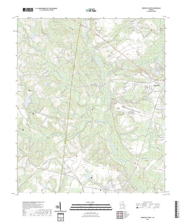
2024 Map of Reidsville West
USGS Topo · Published 2024About this map
The Ohoopee River and its many tributaries, including Brazells Creek and Rocky Creek, define the landscape of Tattnall County west of the city of Reidsville. This 2024 survey captures a rural Georgia environment where agriculture and water resources intersect, evidenced by numerous small lakes and ponds like Winge Lake, Cone Lake, and Chicken Yard Pond. The map serves as a vital resource for genealogical research, identifying several family-named burial grounds such as Ogden Mill Cem, Ryals Cem, and multiple Stanley Cem locations. Public infrastructure is represented by the Swinton Smith Field at Reidsville Municipal Airport, while the western edge of the quadrangle is marked by the Toombs Co Tattnall Co line. The dense network of local roads, such as Shepards Bridge Rd and Oak Bluff Plantation Rd, illustrates the continued importance of timber and farming in this coastal plain region.
Find a feature on this map
127 named features on this map. Tap any name to fly to it.
Don’t see what you’re looking for? This feature index may not catch every label — zoom into the map to look around manually.
Map Details
Editions of this 2024 Reidsville West Map
This is the sole edition of this map. No revisions or reprints were ever made.
Other maps of this area

1953 · Waycross
USGS Topo · 1:250,000

1957 · Macon
USGS Topo · 1:250,000

1958 · Macon
USGS Topo · 1:250,000

1958 · Waycross
USGS Topo · 1:250,000

1964 · Macon
USGS Topo · 1:250,000
1970 · Collins
USGS Topo · 1:24,000

1970 · Johnson Corner
USGS Topo · 1:24,000

1970 · Ohoopee
USGS Topo · 1:24,000

1970 · Reidsville West
USGS Topo · 1:24,000

1970 · Lyons
USGS Topo · 1:24,000