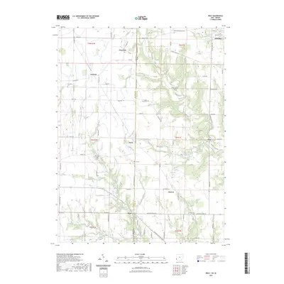
2023 Map of Reily
USGS Topo · Published 2023About this map
The Indiana-Ohio state line bisects this landscape where Butler and Franklin counties meet. Small, long-standing settlements like Reily, Scipio, and Mixersville serve as anchor points for a rural road network that follows the section lines and winding creek beds. The drainage patterns of Indian Creek and the Dry Fork Whitewater River have shaped the placement of local homesteads and historical burial grounds.
Find a feature on this map
80 named features on this map. Tap any name to fly to it.
Don’t see what you’re looking for? This feature index may not catch every label — zoom into the map to look around manually.
Map Details
Editions of this 2023 Reily Map
This is the sole edition of this map. No revisions or reprints were ever made.
Other maps of this area

1911 · Oxford
USGS Topo · 1:62,500

1915 · College Corner
USGS Topo · 1:48,000

1915 · Harrison
USGS Topo · 1:48,000

1915 · Hamilton
USGS Topo · 1:62,500

1917 · Hamilton
USGS Topo · 1:62,500

1918 · College Corner
USGS Topo · 1:62,500

1948 · Fairfield
USGS Topo · 1:24,000

1953 · Cincinnati
USGS Topo · 1:250,000

1955 · Harrison
USGS Topo · 1:24,000

1955 · Reily
USGS Topo · 1:24,000