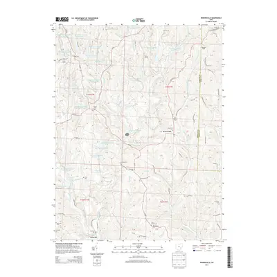
2013 Map of Reinersville
USGS Topo · Published 2013About this map
Reinersville and the surrounding townships of Morgan and Noble counties exhibit a landscape shaped by both natural drainage and industrial water management. This part of southeastern Ohio is defined by the winding paths of Dyes Fork, Meigs Creek, and Little Olive Green Cr. A distinctive feature of this era is the extensive network of artificial ponds managed by the Ohio Power Company, such as Pond Mm-49 and Pond 9515-013, which dot the topography between traditional settlements. Genealogists will find a high density of rural burial grounds including Saint Margaret Cem near Hackney, Windy Hill Cem, and Lebanon Cem. The map traces the transition from the village center at Reinersville to the southern hamlet of Unionville, connected by a web of township roads and state routes.
Find a feature on this map
125 named features on this map. Tap any name to fly to it.
Don’t see what you’re looking for? This feature index may not catch every label — zoom into the map to look around manually.
Map Details
Editions of this 2013 Reinersville Map
This is the sole edition of this map. No revisions or reprints were ever made.
Other maps of this area

1909 · Caldwell
USGS Topo · 1:62,500

1910 · Philo
USGS Topo · 1:62,500

1910 · Mc Connelsville
USGS Topo · 1:62,500

1911 · Cumberland
USGS Topo · 1:62,500

1912 · Caldwell
USGS Topo · 1:62,500

1949 · Clarksburg
USGS Topo · 1:250,000

1956 · Clarksburg
USGS Topo · 1:250,000

1961 · Clarksburg
USGS Topo · 1:250,000
1961 · Beverly
USGS Topo · 1:24,000

1961 · Mc Connelsville
USGS Topo · 1:24,000