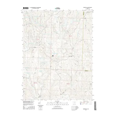
2016 Map of Reinersville
USGS Topo · Published 2016About this map
Reinersville and Hackney anchor a landscape defined by industrial water management and rural cemeteries in this 2016 survey of Morgan and Noble Counties. The region is marked by an extensive series of impoundments associated with power generation, including Ohio Power Company Pond 9515-019 and Ohio Power Company Pond Mm-52, which dot the drainages of Dyes Fork and Horse Run. These artificial features contrast with the traditional settlement pattern of small communities like Bristol and Unionville. Genealogists will find a high density of burial sites across the ridges and hollows, from the Saint Margaret Cem near Hackney to the Kildow Cem and Rehobeth Cem further north. The terrain rises to Browns Knob in the northeast, overlooking a complex network of township roads such as Early Ridge Rd and Wood Grove Rd that weave through the deep valleys of Meigs Creek and Scott Run.
Find a feature on this map
129 named features on this map. Tap any name to fly to it.
Don’t see what you’re looking for? This feature index may not catch every label — zoom into the map to look around manually.
Map Details
Editions of this 2016 Reinersville Map
This is the sole edition of this map. No revisions or reprints were ever made.
Other maps of this area

1909 · Caldwell
USGS Topo · 1:62,500

1910 · Philo
USGS Topo · 1:62,500

1910 · Mc Connelsville
USGS Topo · 1:62,500

1911 · Cumberland
USGS Topo · 1:62,500

1912 · Caldwell
USGS Topo · 1:62,500

1949 · Clarksburg
USGS Topo · 1:250,000

1956 · Clarksburg
USGS Topo · 1:250,000

1961 · Clarksburg
USGS Topo · 1:250,000
1961 · Beverly
USGS Topo · 1:24,000

1961 · Mc Connelsville
USGS Topo · 1:24,000