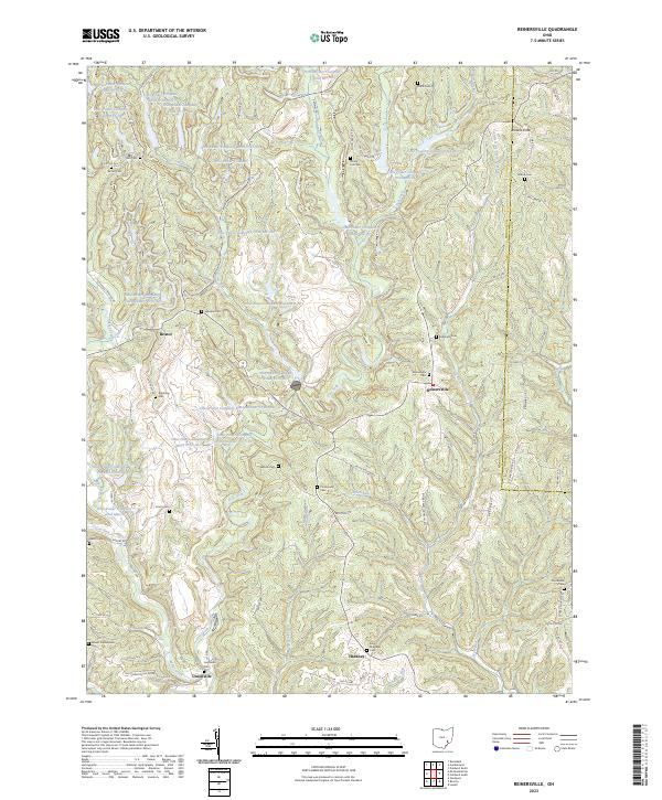
2023 Map of Reinersville
USGS Topo · Published 2023About this map
Dyes Fork and Little Olive Green Creek carve a network of valleys through the southeastern Ohio landscape between Reinersville and Bristol. This modern topographic survey reveals an extensive water management system developed by the Ohio Power Company, consisting of numerous numbered ponds such as Ohio Power Company Pond 9515-019 and Ohio Power Company Pond Mm-85 scattered across the northern sections. For genealogists and local historians, the map is remarkably dense with burial sites, including the Kuntz Cem, Reinersville Cem, and the high-elevation Windy Hill Cem. The settlement pattern follows the ridgelines and creek bottoms, with small communities like Hackney and Unionville connected by winding roads such as Oak Grove Rd and Sawmill Rd.
Find a feature on this map
102 named features on this map. Tap any name to fly to it.
Don’t see what you’re looking for? This feature index may not catch every label — zoom into the map to look around manually.
Map Details
Editions of this 2023 Reinersville Map
This is the sole edition of this map. No revisions or reprints were ever made.
Other maps of this area

1909 · Caldwell
USGS Topo · 1:62,500

1910 · Philo
USGS Topo · 1:62,500

1910 · Mc Connelsville
USGS Topo · 1:62,500

1911 · Cumberland
USGS Topo · 1:62,500

1912 · Caldwell
USGS Topo · 1:62,500

1949 · Clarksburg
USGS Topo · 1:250,000

1956 · Clarksburg
USGS Topo · 1:250,000

1961 · Clarksburg
USGS Topo · 1:250,000
1961 · Beverly
USGS Topo · 1:24,000

1961 · Mc Connelsville
USGS Topo · 1:24,000