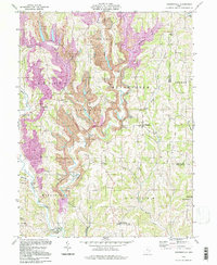
1994 Map of Reinersville
USGS Topo · Published 1998About this map
Extensive Strip Mines and a complex industrial conveyor system dominate the hills of Morgan and Noble counties in this mid-1990s survey. The landscape of the Bristol and Manchester townships is defined by heavy extraction activities that carve through the ridges between Meigs Creek and Olive Green Creek. Despite the massive industrial footprint, small rural settlements like Reinersville and Hackney persist, anchored by a dense network of local family cemeteries and country churches. The presence of a conveyor system stretching across the central hills highlights the scale of resource transport during this era. Genealogists will find a wealth of named landmarks, including Kuntz Cem and Emery Ch Cem, tucked into the valleys of Dyes Run and Horse Run, while topographic landmarks like Browns Knob provide a sense of the original elevation before mining operations.
Find a feature on this map
44 named features on this map. Tap any name to fly to it.
Don’t see what you’re looking for? This feature index may not catch every label — zoom into the map to look around manually.
Map Details
Editions of this 1994 Reinersville Map
This is the sole edition of this map. No revisions or reprints were ever made.
Other maps of this area

1909 · Caldwell
USGS Topo · 1:62,500

1910 · Philo
USGS Topo · 1:62,500

1910 · Mc Connelsville
USGS Topo · 1:62,500

1911 · Cumberland
USGS Topo · 1:62,500

1912 · Caldwell
USGS Topo · 1:62,500

1949 · Clarksburg
USGS Topo · 1:250,000

1956 · Clarksburg
USGS Topo · 1:250,000

1961 · Clarksburg
USGS Topo · 1:250,000
1961 · Beverly
USGS Topo · 1:24,000

1961 · Mc Connelsville
USGS Topo · 1:24,000