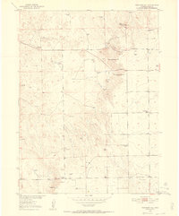
1951 Map of Reiradon Hill
USGS Topo · Published 1952About this map
North Reiradon Hill and South Reiradon Hill anchor this rural Logan County landscape during the early 1950s, surveyed as part of the Department of the Interior's Missouri River Basin development program. The map reveals a sparsely populated ranching and utility corridor, where numerous Windmills signify the critical importance of groundwater in this high plains environment. Public infrastructure of the era is evident through the State Patrol Pistol Range and the State Patrol Radio Relay Station, reflecting the mid-century expansion of state communications. Education and community life are grounded at the Fyffe School and Eagle Point School, while local topography is punctuated by features like The Cave and Eagle Point Hill. The presence of a Buffalo Camp and a private Airstrip further illustrates the specialized land use found in this part of northeastern Colorado.
Find a feature on this map
17 named features on this map. Tap any name to fly to it.
Don’t see what you’re looking for? This feature index may not catch every label — zoom into the map to look around manually.
Map Details
Editions of this 1951 Reiradon Hill Map
4 editions found
Other maps of this area

1951 · Reiradon Hill
USGS Topo · 1:24,000

1951 · Sterling South
USGS Topo · 1:24,000

1951 · Sterling North
USGS Topo · 1:24,000

1951 · Galien
USGS Topo · 1:24,000

1954 · Sterling
USGS Topo · 1:250,000

1958 · Sterling
USGS Topo · 1:250,000

1962 · Uhler Ranch
USGS Topo · 1:24,000

1972 · Glacken Hill
USGS Topo · 1:24,000

1972 · Leroy
USGS Topo · 1:24,000

1973 · Buffalo Springs Ranch NW
USGS Topo · 1:24,000