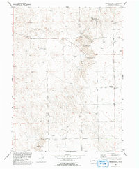
1951 Map of Reiradon Hill
USGS Topo · Published 1992About this map
Buffalo Camp and the high plains of Logan County are documented here in this survey conducted for the development of the Missouri River Basin. The landscape is defined by its agricultural utility and early infrastructure, notably punctuated by dozens of windmills and small gravel operations such as the Gravel Pits north of North Reiradon Hill. Social hubs of this rural community center on the Fyffe School and Eagle Point School, providing essential locations for genealogical research in this sparsely populated region.
Find a feature on this map
21 named features on this map. Tap any name to fly to it.
Don’t see what you’re looking for? This feature index may not catch every label — zoom into the map to look around manually.
Map Details
Editions of this 1951 Reiradon Hill Map
4 editions found
Other maps of this area

1951 · Reiradon Hill
USGS Topo · 1:24,000

1951 · Sterling South
USGS Topo · 1:24,000

1951 · Sterling North
USGS Topo · 1:24,000

1951 · Galien
USGS Topo · 1:24,000

1954 · Sterling
USGS Topo · 1:250,000

1958 · Sterling
USGS Topo · 1:250,000

1962 · Uhler Ranch
USGS Topo · 1:24,000

1972 · Glacken Hill
USGS Topo · 1:24,000

1972 · Leroy
USGS Topo · 1:24,000

1973 · Buffalo Springs Ranch NW
USGS Topo · 1:24,000