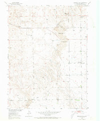
1951 Map of Reiradon Hill
USGS Topo · Published 1973About this map
North Reiradon Hill and South Reiradon Hill command the high ground of this northeastern Colorado landscape, a terrain defined by its dependence on wind power and scattered public infrastructure. Dozens of windmills, including the distinctively named Twin Mills, are plotted across the township sections, signaling the critical importance of groundwater for the livestock and ranching operations of the era. The presence of Buffalo Camp suggests a history of seasonal or temporary settlement in the northern reaches of Logan County.
Find a feature on this map
17 named features on this map. Tap any name to fly to it.
Don’t see what you’re looking for? This feature index may not catch every label — zoom into the map to look around manually.
Map Details
Editions of this 1951 Reiradon Hill Map
4 editions found
Other maps of this area

1951 · Reiradon Hill
USGS Topo · 1:24,000

1951 · Sterling South
USGS Topo · 1:24,000

1951 · Sterling North
USGS Topo · 1:24,000

1951 · Galien
USGS Topo · 1:24,000

1954 · Sterling
USGS Topo · 1:250,000

1958 · Sterling
USGS Topo · 1:250,000

1962 · Uhler Ranch
USGS Topo · 1:24,000

1972 · Glacken Hill
USGS Topo · 1:24,000

1972 · Leroy
USGS Topo · 1:24,000

1973 · Buffalo Springs Ranch NW
USGS Topo · 1:24,000