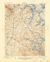
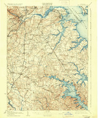
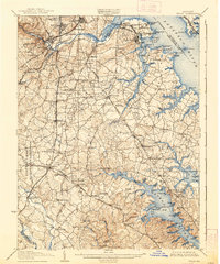
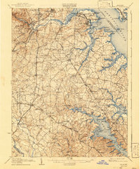
1907 Map of Relay
USGS Topo · Published 1946About this map
Fort Mc Henry and Fort Carroll guard the approaches to the upper Patapsco River in this early twentieth-century survey of the region surrounding Baltimore and northern Anne Arundel County. The map captures a transitional landscape where established river landings like Indian Ldg. and Whitneys Landing coexist with a rapidly expanding rail network. The density of industrial and transport infrastructure is evident in the complex web of lines including the Baltimore and Ohio Railroad and the Washington Baltimore and Annapolis Electric Railroad.
Find a feature on this map
163 named features on this map. Tap any name to fly to it.
Don’t see what you’re looking for? This feature index may not catch every label — zoom into the map to look around manually.
Map Details
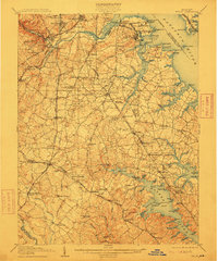
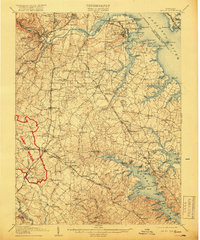
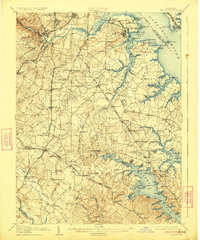
Editions of this 1907 Relay Map
8 editions found

Other maps of this area

1892 · Laurel
USGS Topo · 1:62,500

1892 · Ellicott
USGS Topo · 1:62,500

1892 · Owensville
USGS Topo · 1:62,500

1892 · Annapolis
USGS Topo · 1:62,500

1893 · North Point
USGS Topo · 1:62,500

1893 · Gunpowder
USGS Topo · 1:62,500

1894 · Ellicott
USGS Topo · 1:62,500

1894 · Laurel
USGS Topo · 1:62,500

1894 · Baltimore
USGS Topo · 1:62,500

1894 · Relay
USGS Topo · 1:62,500