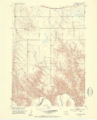
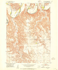
1952 Map of Reliance SW
USGS Topo · Published 1954About this map
The southern boundary of Lyman and Tripp counties follows the winding course of the White River in this mid-century survey. The landscape is defined by the erosion-carved breaks and drainage systems of Bad Creek and Red Butte Creek, which flow southward toward the river. To the north, the terrain transitions into the high plains of Reliance, marked by the prominent elevation of Red Butte. Settlement patterns are distinctly rural, centered on local education and faith as evidenced by the Hieb Sch and Roosevelt Sch, alongside the Trinity Cem and Reformed Ch Cem. The Chicago Milwaukee St Paul and Pacific railroad skims the northern edge, while landmarks like the Nelson Ranch and Heap Lake provide specific points of reference for local historians studying 1950s land use and ranching history.
Find a feature on this map
18 named features on this map. Tap any name to fly to it.
Don’t see what you’re looking for? This feature index may not catch every label — zoom into the map to look around manually.
Map Details
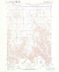
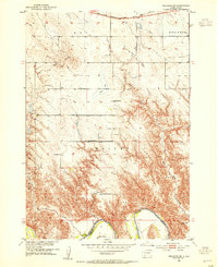
Editions of this 1952 Reliance SW Map
3 editions found
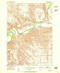
Other maps of this area
1951 · Ideal NE
USGS Topo · 1:24,000
1952 · Reliance SW
USGS Topo · 1:24,000

1952 · Reliance SE
USGS Topo · 1:24,000
1952 · Hamill NW
USGS Topo · 1:24,000

1952 · Hamill NE
USGS Topo · 1:24,000

1955 · Mitchell
USGS Topo · 1:250,000

1959 · Mitchell
USGS Topo · 1:250,000
1978 · Lyman
USGS Topo · 1:24,000
1978 · Kennebec SE
USGS Topo · 1:24,000
1978 · Reliance
USGS Topo · 1:24,000