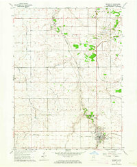
1963 Map of Remington
USGS Topo · Published 1964About this map
The Pennsylvania railroad corridor anchors the town of Remington, serving as the primary industrial axis for this portion of Jasper County in the early 1960s. The landscape is defined by an extensive network of agricultural drainage, including the Simonin Ditch, Gushwa Ditch, and Claude May Ditch, which channel water toward Carpenter Creek. This hydraulic engineering reflects the intensive land use of the Marion, Jordan, and Carpenter townships.
Find a feature on this map
25 named features on this map. Tap any name to fly to it.
Don’t see what you’re looking for? This feature index may not catch every label — zoom into the map to look around manually.
Map Details
Editions of this 1963 Remington Map
2 editions found
Other maps of this area

1953 · Danville
USGS Topo · 1:250,000

1955 · Danville
USGS Topo · 1:250,000

1956 · Danville
USGS Topo · 1:250,000

1961 · Mount Ayr
USGS Topo · 1:24,000

1962 · Mount Gilboa
USGS Topo · 1:24,000

1962 · Wadena
USGS Topo · 1:24,000

1962 · Templeton NE
USGS Topo · 1:24,000

1962 · Goodland
USGS Topo · 1:24,000
1962 · Mc Coysburg
USGS Topo · 1:24,000
1962 · Rensselaer
USGS Topo · 1:24,000