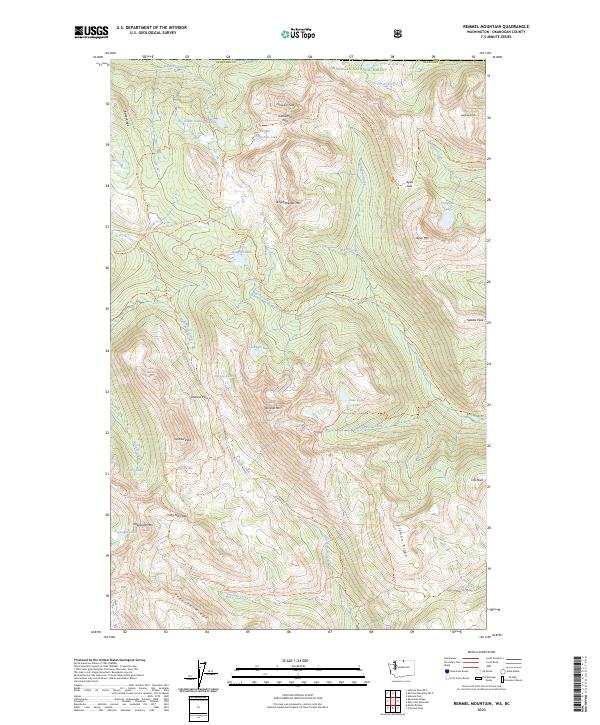
2023 Map of Remmel Mountain
USGS Topo · Published 2023About this map
Pasayten Wilderness and the Okanogan National Forest dominate this high-altitude landscape in northern Washington. The terrain is defined by prominent peaks including Remmel Mtn, Cathedral Peak, and Amphitheater Mtn, which serve as the headwaters for many sub-alpine drainages. An extensive network of backcountry routes, such as the Pacific Northwest National Scenic Trl and Chewuch Trl, facilitates travel through these protected lands.
Find a feature on this map
60 named features on this map. Tap any name to fly to it.
Don’t see what you’re looking for? This feature index may not catch every label — zoom into the map to look around manually.
Map Details
Editions of this 2023 Remmel Mountain Map
This is the sole edition of this map. No revisions or reprints were ever made.
Other maps of this area

1955 · Concrete
USGS Topo · 1:250,000

1958 · Concrete
USGS Topo · 1:250,000

1962 · Concrete
USGS Topo · 1:250,000

1969 · Mt. Barney
USGS Topo · 1:24,000

1969 · Remmel Mtn.
USGS Topo · 1:24,000

1969 · Billy Goat Mtn
USGS Topo · 1:24,000

1969 · Ashnola Pass
USGS Topo · 1:24,000
1969 · Coleman Peak
USGS Topo · 1:24,000
1969 · Bauerman Ridge
USGS Topo · 1:24,000
2001 · Coleman Peak
USGS Topo · 1:24,000