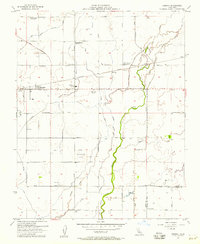
1954 Map of Remnoy
USGS Topo · Published 1957About this map
Agricultural development and complex water management define this landscape on the boundary between Kings and Tulare counties in the mid-1950s. The Southern Pacific rail line serves as the primary corridor for settlements like Hamblin and Remnoy, while a dense network of irrigation features including the Peoples Ditch and Flint Avenue Canal redirect water across the valley floor. The map documents a period of shifting educational infrastructure, noting several decommissioned sites such as Wayne School and Eureka School, while Kit Carson School remains active. Unusual landmarks like a Racetrack near Guernsey Slough and the KNGS Radio Towers provide specific points of interest for local historians. Large-scale water control is evident through the Percolation Basin and the winding course of Cross Creek, illustrating the extensive engineering required to support the region's farming economy.
Find a feature on this map
44 named features on this map. Tap any name to fly to it.
Don’t see what you’re looking for? This feature index may not catch every label — zoom into the map to look around manually.
Map Details
Editions of this 1954 Remnoy Map
3 editions found
Other maps of this area

1926 · Goshen
USGS Topo · 1:31,680

1926 · Hanford
USGS Topo · 1:31,680

1926 · Burris Park
USGS Topo · 1:31,680

1927 · Traver
USGS Topo · 1:31,680

1927 · Laton
USGS Topo · 1:31,680

1927 · Remnoy
USGS Topo · 1:31,680

1927 · Paige
USGS Topo · 1:31,680

1928 · Waukena
USGS Topo · 1:31,680

1929 · Guernsey
USGS Topo · 1:31,680
1942 · Corcoran
USGS Topo · 1:62,500