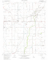
1954 Map of Remnoy
USGS Topo · Published 1984About this map
Agriculture and water management dominate this Kings County landscape, where the Southern Pacific tracks run parallel to Lacey Boulevard through the central San Joaquin Valley. Small agricultural clusters like Remnoy and Hamblin serve as local hubs for the surrounding farmsteads, which are interconnected by an extensive grid of irrigation infrastructure including the Highline Canal, Lakeside Ditch, and Cross Creek. A notable shift in the local social landscape is evidenced by the presence of multiple defunct educational sites, including Eureka School (Aban'd), Wayne School (Abandoned), and Willow Grove Sch (Aban'd).
Find a feature on this map
36 named features on this map. Tap any name to fly to it.
Don’t see what you’re looking for? This feature index may not catch every label — zoom into the map to look around manually.
Map Details
Editions of this 1954 Remnoy Map
3 editions found
Other maps of this area

1926 · Goshen
USGS Topo · 1:31,680

1926 · Hanford
USGS Topo · 1:31,680

1926 · Burris Park
USGS Topo · 1:31,680

1927 · Traver
USGS Topo · 1:31,680

1927 · Laton
USGS Topo · 1:31,680

1927 · Remnoy
USGS Topo · 1:31,680

1927 · Paige
USGS Topo · 1:31,680

1928 · Waukena
USGS Topo · 1:31,680

1929 · Guernsey
USGS Topo · 1:31,680
1942 · Corcoran
USGS Topo · 1:62,500