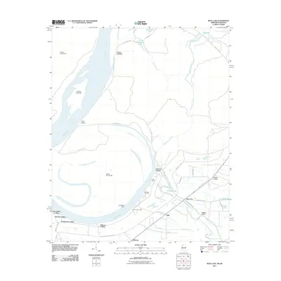
2011 Map of Rena Lara
USGS Topo · Published 2011About this map
Sunflower Landing and the riverfront communities of Coahoma County define this 2011 survey, situated along a complex stretch of the Mississippi River. The landscape is dominated by the dynamic shifts of the river's course, evidenced by features like Sunflower Bend and Desoto Lake, which was once part of the main channel. The map details a series of historical landings and revetments that served the river-based economy, including Pushmataha Landing and Rescue Landing. Inland, the settlement pattern follows the drainage of the Hushpuckena River and its creeks, where small communities such as Rena Lara, Walnut Grove, and Green Grove are established among a network of local roads. This survey illustrates the ongoing relationship between human habitation and the alluvial landscape of the Mississippi Delta, specifically how the levee system and road networks like Desoto Trail Rd coordinate with the natural waterways.
Find a feature on this map
48 named features on this map. Tap any name to fly to it.
Don’t see what you’re looking for? This feature index may not catch every label — zoom into the map to look around manually.
Map Details
Editions of this 2011 Rena Lara Map
This is the sole edition of this map. No revisions or reprints were ever made.
Other maps of this area

1930 · Mellwood
USGS Topo · 1:62,500

1935 · Clarksdale
USGS Topo · 1:62,500

1939 · Farrell
USGS Topo · 1:62,500

1939 · Modoc
USGS Topo · 1:62,500

1939 · Clarksdale
USGS Topo · 1:62,500

1939 · Mellwood
USGS Topo · 1:62,500

1948 · Helena
USGS Topo · 1:250,000

1948 · Modoc
USGS Topo · 1:62,500

1950 · Helena
USGS Topo · 1:250,000

1954 · Mellwood
USGS Topo · 1:62,500