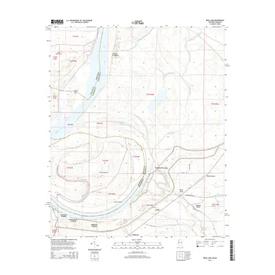
2015 Map of Rena Lara
USGS Topo · Published 2015About this map
The Mississippi River shapes the western boundary of this landscape, carving a complex network of oxbows and secondary channels along the Arkansas and Mississippi border. The shifting hydrology of the river is evident in features like Sunflower Bend and Desoto Lake, which represent the historical meanders of this waterway. This area is characterized by numerous river-access points and small communities, including Sunflower Landing and Rena Lara, which reflect the region's historical reliance on the river for transport and trade.
Find a feature on this map
53 named features on this map. Tap any name to fly to it.
Don’t see what you’re looking for? This feature index may not catch every label — zoom into the map to look around manually.
Map Details
Editions of this 2015 Rena Lara Map
This is the sole edition of this map. No revisions or reprints were ever made.
Other maps of this area

1930 · Mellwood
USGS Topo · 1:62,500

1935 · Clarksdale
USGS Topo · 1:62,500

1939 · Farrell
USGS Topo · 1:62,500

1939 · Modoc
USGS Topo · 1:62,500

1939 · Clarksdale
USGS Topo · 1:62,500

1939 · Mellwood
USGS Topo · 1:62,500

1948 · Helena
USGS Topo · 1:250,000

1948 · Modoc
USGS Topo · 1:62,500

1950 · Helena
USGS Topo · 1:250,000

1954 · Mellwood
USGS Topo · 1:62,500