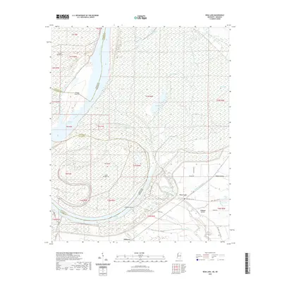
2020 Map of Rena Lara
USGS Topo · Published 2020About this map
Mississippi River meanders define the border between Mississippi and Arkansas in this delta landscape, where the shifting riverbed has created a complex network of oxbows and islands. Large water bodies like Desoto Lake and the Chute of Island serve as geographic markers of the river's historic path, while landforms such as Sunflower Bend and Jackson Cut-Off illustrate the dynamic alluvial environment. The community of Rena Lara sits at a junction of local roads, including the Bobo - Rena Lara Rd and Alligator Rena Lara Rd, which connect the rural settlements of the Coahoma County interior.
Find a feature on this map
53 named features on this map. Tap any name to fly to it.
Don’t see what you’re looking for? This feature index may not catch every label — zoom into the map to look around manually.
Map Details
Editions of this 2020 Rena Lara Map
This is the sole edition of this map. No revisions or reprints were ever made.
Other maps of this area

1930 · Mellwood
USGS Topo · 1:62,500

1935 · Clarksdale
USGS Topo · 1:62,500

1939 · Farrell
USGS Topo · 1:62,500

1939 · Modoc
USGS Topo · 1:62,500

1939 · Clarksdale
USGS Topo · 1:62,500

1939 · Mellwood
USGS Topo · 1:62,500

1948 · Helena
USGS Topo · 1:250,000

1948 · Modoc
USGS Topo · 1:62,500

1950 · Helena
USGS Topo · 1:250,000

1954 · Mellwood
USGS Topo · 1:62,500