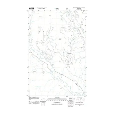
2011 Map of Rendevous Mountain
USGS Topo · Published 2011About this map
Grizzly Mountain and Rendezvous Mountain dominate this part of the Methow Valley, where the Methow River flows south past Mazama Camp. The landscape reflects a mix of resource extraction and high-elevation passage, centered around the Montana Mine near Montana Creek and the connectivity provided by Rendezvous Pass. A complex network of Forest Service and ranch roads, including Wolf Creek Rd and Goat Creek Rd, traverses the slopes and canyons.
Find a feature on this map
45 named features on this map. Tap any name to fly to it.
Don’t see what you’re looking for? This feature index may not catch every label — zoom into the map to look around manually.
Map Details
Editions of this 2011 Rendevous Mountain Map
This is the sole edition of this map. No revisions or reprints were ever made.
Other maps of this area

1899 · Methow
USGS Topo · 1:125,000

1901 · Methow
USGS Topo · 1:125,000

1955 · Concrete
USGS Topo · 1:250,000

1958 · Concrete
USGS Topo · 1:250,000

1962 · Concrete
USGS Topo · 1:250,000

1962 · Mazama
USGS Topo · 1:62,500

1963 · Doe Mountain
USGS Topo · 1:62,500
1969 · Midnight Mtn.
USGS Topo · 1:24,000
1969 · Thompson Ridge
USGS Topo · 1:24,000
1969 · Buttermilk Butte
USGS Topo · 1:62,500