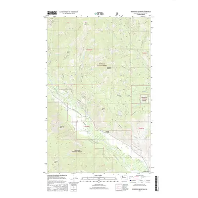
2017 Map of Rendevous Mountain
USGS Topo · Published 2017About this map
Rendevous Mountain and the high ridges of the Okanogan National Forest dominate this high-country landscape in the upper Methow Valley. The Methow River flows through the southern portion of the quadrangle, crossed by the Weeman Bridge and flanked by landmarks such as Lucky Jim Bluff and Boesel Canyon. The terrain transitions from the valley floor to prominent summits like Fawn Peak and Grizzly Mtn, with Virginian Ridge defining the southwestern horizon.
Find a feature on this map
67 named features on this map. Tap any name to fly to it.
Don’t see what you’re looking for? This feature index may not catch every label — zoom into the map to look around manually.
Map Details
Editions of this 2017 Rendevous Mountain Map
This is the sole edition of this map. No revisions or reprints were ever made.
Other maps of this area

1899 · Methow
USGS Topo · 1:125,000

1901 · Methow
USGS Topo · 1:125,000

1955 · Concrete
USGS Topo · 1:250,000

1958 · Concrete
USGS Topo · 1:250,000

1962 · Concrete
USGS Topo · 1:250,000

1962 · Mazama
USGS Topo · 1:62,500

1963 · Doe Mountain
USGS Topo · 1:62,500
1969 · Midnight Mtn.
USGS Topo · 1:24,000
1969 · Thompson Ridge
USGS Topo · 1:24,000
1969 · Buttermilk Butte
USGS Topo · 1:62,500