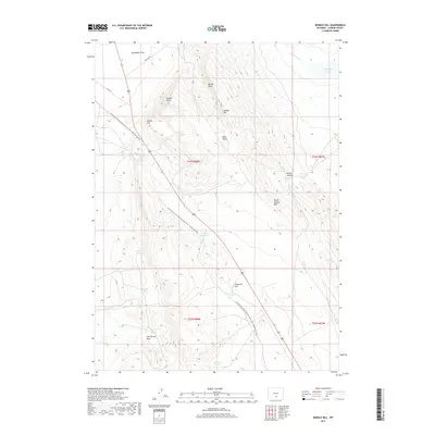
2017 Map of Rendle Hill
USGS Topo · Published 2017About this map
Continental Divide National Scenic Trail- Wyoming Portion snakes across this high-desert landscape in Carbon County, tracing a path through a series of significant topographical landmarks. The terrain is defined by dramatic elevations and depressions, such as Rendle Hill, Ninemile Hill, and the wide expanse of Separation Flats to the north. Water sources are critical features in this arid region, marked by numerous springs including Chicken Spring, Buck Spring, and the Brown Canyon Springs complex. The mapping of Fish Pond Reservoir and Separation Lake indicates managed water resources and natural basins that have historically supported grazing and travel through these basins. Local transit is facilitated by Buzzard RD and Co RD 63, providing access to the more remote corners of Olsen Basin and the slopes of Willow Hill.
Find a feature on this map
26 named features on this map. Tap any name to fly to it.
Don’t see what you’re looking for? This feature index may not catch every label — zoom into the map to look around manually.
Map Details
Editions of this 2017 Rendle Hill Map
This is the sole edition of this map. No revisions or reprints were ever made.
Other maps of this area

1953 · Riddle Cut
USGS Topo · 1:24,000

1953 · Rawlins
USGS Topo · 1:24,000

1953 · Rawlins NW
USGS Topo · 1:24,000

1954 · Rawlins
USGS Topo · 1:250,000

1955 · Casper
USGS Topo · 1:250,000

1956 · Rawlins Peak
USGS Topo · 1:62,500

1958 · Rawlins
USGS Topo · 1:250,000

1958 · Casper
USGS Topo · 1:250,000

1960 · Separation Rim
USGS Topo · 1:24,000

1960 · Boggy Meadows
USGS Topo · 1:24,000