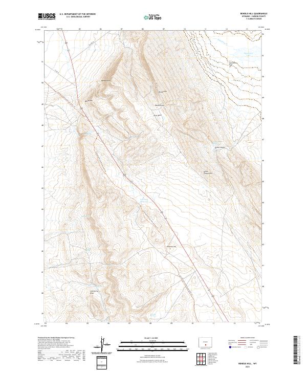
2021 Map of Rendle Hill
USGS Topo · Published 2021About this map
The Continental Divide National Scenic Trl bisects this high-elevation Wyoming landscape, tracing a path through the diverse terrain of Rendle Hill and Ninemile Hill. This 2021 survey reveals a territory defined by its water sources and drainage patterns, including the notable Separation Lake and Separation Cr in the northeast corner. The map documents numerous isolated water points such as Bell Springs, Buck Spring, and Chicken Spring, which are critical landmarks in the arid expanse of Olsen Basin.
Find a feature on this map
27 named features on this map. Tap any name to fly to it.
Don’t see what you’re looking for? This feature index may not catch every label — zoom into the map to look around manually.
Map Details
Editions of this 2021 Rendle Hill Map
This is the sole edition of this map. No revisions or reprints were ever made.
Other maps of this area

1953 · Riddle Cut
USGS Topo · 1:24,000

1953 · Rawlins
USGS Topo · 1:24,000

1953 · Rawlins NW
USGS Topo · 1:24,000

1954 · Rawlins
USGS Topo · 1:250,000

1955 · Casper
USGS Topo · 1:250,000

1956 · Rawlins Peak
USGS Topo · 1:62,500

1958 · Rawlins
USGS Topo · 1:250,000

1958 · Casper
USGS Topo · 1:250,000

1960 · Separation Rim
USGS Topo · 1:24,000

1960 · Boggy Meadows
USGS Topo · 1:24,000