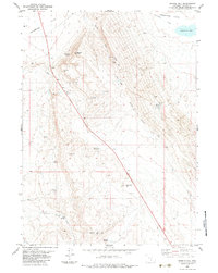
1983 Map of Rendle Hill
USGS Topo · Published 1983About this map
Separation Flats dominate the northern landscape of this Carbon County terrain, where the waters of Separation Creek feed into Separation Lake. The map reveals a high-altitude environment defined by complex drainage systems and name-bearing landmarks like Rendle Point and Rendle Hill. This 1983 survey documents a remote landscape where water sources are the primary points of interest for livestock and local travel, evidenced by the concentration of named springs including Bell Springs, Buck Spring, and Ninemile Springs. A single pipeline corridor cuts diagonally across the center, indicating the energy infrastructure typical of the region during the late twentieth century. Industrial activity is further noted by a Gravel Pit and a Drill Hole in the northwest, while topographic features like the Brown Canyon Rim and Olsen Basin illustrate the varied relief of the Wyoming high country.
Find a feature on this map
28 named features on this map. Tap any name to fly to it.
Don’t see what you’re looking for? This feature index may not catch every label — zoom into the map to look around manually.
Map Details
Editions of this 1983 Rendle Hill Map
This is the sole edition of this map. No revisions or reprints were ever made.
Other maps of this area

1953 · Riddle Cut
USGS Topo · 1:24,000

1953 · Rawlins
USGS Topo · 1:24,000

1953 · Rawlins NW
USGS Topo · 1:24,000

1954 · Rawlins
USGS Topo · 1:250,000

1955 · Casper
USGS Topo · 1:250,000

1956 · Rawlins Peak
USGS Topo · 1:62,500

1958 · Rawlins
USGS Topo · 1:250,000

1958 · Casper
USGS Topo · 1:250,000

1960 · Separation Rim
USGS Topo · 1:24,000

1960 · Boggy Meadows
USGS Topo · 1:24,000