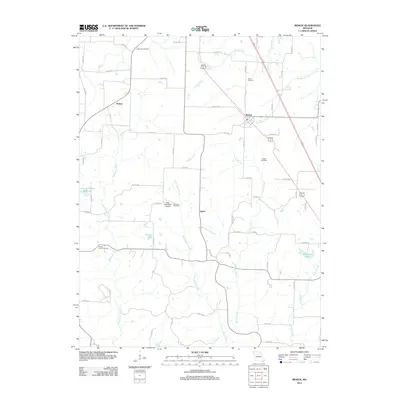
2012 Map of Renick
USGS Topo · Published 2012About this map
Renick sits at the heart of this landscape, surrounded by a network of drainage systems including Coon Creek, Galbreath Creek, and Perche Creek. The 2012 topography reveals a rural pattern of development where family and community landmarks such as Anderson Cemetery, Davis Cemetery, and Sandy Hook Cemetery anchor the local history across the countryside. Near the center of the quadrangle, the Hess-McKeown Airport is positioned between Little Perche Creek and Hamilton Cemetery, illustrating the modern overlay of transportation on an area historically defined by its watercourses. The presence of the City of Higbee Reservoir and various water bodies like Gonyea Lake and Backues Lake emphasize the importance of water management in this part of Randolph County. Small settlements like Harkes and Ryder appear along the extensive county road system, preserving the identity of these rural Missouri communities into the early 21st century.
Find a feature on this map
59 named features on this map. Tap any name to fly to it.
Don’t see what you’re looking for? This feature index may not catch every label — zoom into the map to look around manually.
Map Details
Editions of this 2012 Renick Map
This is the sole edition of this map. No revisions or reprints were ever made.
Other maps of this area

1890 · Moberly
USGS Topo · 1:125,000

1890 · Glasgow
USGS Topo · 1:125,000

1917 · Sturgeon
USGS Topo · 1:62,500

1952 · Middle Grove
USGS Topo · 1:24,000

1953 · Moberly
USGS Topo · 1:250,000

1953 · Burton
USGS Topo · 1:24,000

1953 · Renick
USGS Topo · 1:24,000

1953 · Huntsville
USGS Topo · 1:24,000

1953 · Higbee
USGS Topo · 1:24,000

1953 · Clark
USGS Topo · 1:24,000