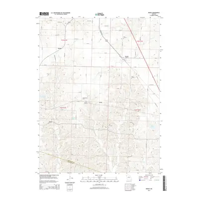
2014 Map of Renick
USGS Topo · Published 2014About this map
The town of Renick and the surrounding farmland of southern Randolph County are defined by the headwaters of several significant Missouri drainage systems. This 2014 survey captures a rural landscape where small settlements like Harkes and Ryder serve as points of orientation for a network of county roads. The terrain is marked by multiple water bodies, including the City of Higbee Reservoir and Gonyea Lake, which reflect the region's managed water resources alongside natural systems like Moniteau Cr and Coon Cr.
Find a feature on this map
68 named features on this map. Tap any name to fly to it.
Don’t see what you’re looking for? This feature index may not catch every label — zoom into the map to look around manually.
Map Details
Editions of this 2014 Renick Map
This is the sole edition of this map. No revisions or reprints were ever made.
Other maps of this area

1890 · Moberly
USGS Topo · 1:125,000

1890 · Glasgow
USGS Topo · 1:125,000

1917 · Sturgeon
USGS Topo · 1:62,500

1952 · Middle Grove
USGS Topo · 1:24,000

1953 · Moberly
USGS Topo · 1:250,000

1953 · Burton
USGS Topo · 1:24,000

1953 · Renick
USGS Topo · 1:24,000

1953 · Huntsville
USGS Topo · 1:24,000

1953 · Higbee
USGS Topo · 1:24,000

1953 · Clark
USGS Topo · 1:24,000