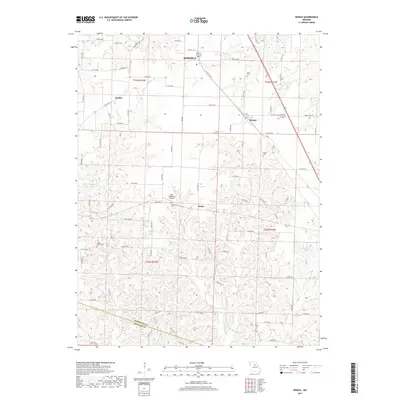
2017 Map of Renick
USGS Topo · Published 2017About this map
Moberly and the surrounding agricultural landscape of Randolph and Howard Counties are defined by the winding tributaries that feed into the Missouri River watershed. This survey captures a network of creeks, including Moniteau Cr, Coon Cr, and Perche Cr, which carve through the terrain and dictated early settlement patterns. Small communities like Renick, Harkes, and Ryder serve as local anchors, connected by a web of county roads and state highways like State Hwy A and State Hwy B.
Find a feature on this map
88 named features on this map. Tap any name to fly to it.
Don’t see what you’re looking for? This feature index may not catch every label — zoom into the map to look around manually.
Map Details
Editions of this 2017 Renick Map
This is the sole edition of this map. No revisions or reprints were ever made.
Other maps of this area

1890 · Moberly
USGS Topo · 1:125,000

1890 · Glasgow
USGS Topo · 1:125,000

1917 · Sturgeon
USGS Topo · 1:62,500

1952 · Middle Grove
USGS Topo · 1:24,000

1953 · Moberly
USGS Topo · 1:250,000

1953 · Burton
USGS Topo · 1:24,000

1953 · Renick
USGS Topo · 1:24,000

1953 · Huntsville
USGS Topo · 1:24,000

1953 · Higbee
USGS Topo · 1:24,000

1953 · Clark
USGS Topo · 1:24,000