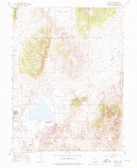
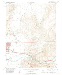
1967 Map of Reno NE
USGS Topo · Published 1976About this map
Lemmon Valley sits at the heart of this Nevada landscape, showing the transition from mid-century ranching and mineral exploration to a growing residential footprint on the outskirts of Reno. The presence of the Reno-Stead Airport and an adjacent Military Reservation defines the western edge of the quadrangle, reflecting the area's strategic aeronautical and logistical importance. A systematic street grid is emerging in the valley, with roads named after states like Oregon Blvd, Idaho Blvd, and Arkansas St providing structure to the new housing developments.
Find a feature on this map
35 named features on this map. Tap any name to fly to it.
Don’t see what you’re looking for? This feature index may not catch every label — zoom into the map to look around manually.
Map Details
Editions of this 1967 Reno NE Map
4 editions found
Other maps of this area

1891 · Reno
USGS Topo · 1:125,000

1893 · Reno
USGS Topo · 1:125,000

1950 · Reno
USGS Topo · 1:62,500

1951 · Reno
USGS Topo · 1:62,500

1957 · Sutcliffe
USGS Topo · 1:62,500
1957 · Vista
USGS Topo · 1:24,000

1957 · Dogskin Mountain
USGS Topo · 1:62,500

1957 · Spanish Springs Valley
USGS Topo · 1:62,500

1957 · Reno
USGS Topo · 1:250,000

1959 · Reno
USGS Topo · 1:250,000