
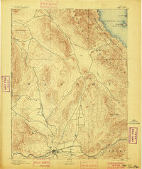
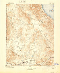
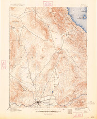
1893 Map of Reno
USGS Topo · Published 1893About this map
Reno serves as the focal point of this late-nineteenth-century landscape, positioned where the Truckee River flows through the Truckee Meadows. The map illustrates a critical rail junction, featuring the Central Pacific Railroad, the V. & T. R. R., and the Nevada and Oregon Railroad radiating from the growing city. To the north, the terrain transitions into the high desert peaks of the Virginia Mountains and the vast waters of Pyramid Lake, which is largely contained within the Pyramid Lake Indian Reservation.
Find a feature on this map
34 named features on this map. Tap any name to fly to it.
Don’t see what you’re looking for? This feature index may not catch every label — zoom into the map to look around manually.
Map Details
Editions of this 1893 Reno Map
7 editions found
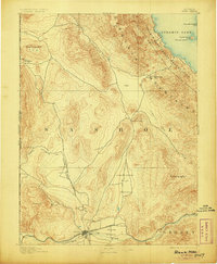
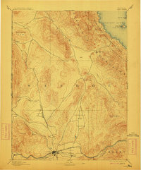
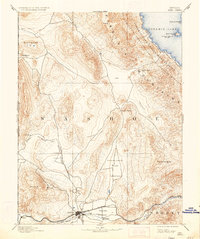
Other maps of this area

1886 · Honey Lake
USGS Topo · 1:250,000

1886 · Granite Range
USGS Topo · 1:250,000

1890 · Wadsworth
USGS Topo · 1:125,000

1890 · Sierraville
USGS Topo · 1:125,000

1891 · Honey Lake
USGS Topo · 1:250,000

1891 · Carson
USGS Topo · 1:125,000

1891 · Truckee
USGS Topo · 1:125,000

1891 · Wabuska
USGS Topo · 1:125,000

1891 · Reno
USGS Topo · 1:125,000

1892 · Wadsworth
USGS Topo · 1:125,000