
1957 Map of Reno
USGS Topo · Published 1963About this map
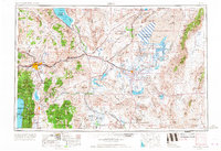
Pyramid Lake and the vast Carson Sink dominate this high-desert landscape of western Nevada during the early 1960s. The regional centers of Reno and Sparks sit at the foot of the Virginia Range, while Carson City and Genoa anchor the southern reaches near the Toiyabe National Forest. The map captures a transition in land use, showing extensive conservation and tribal lands like the Stillwater National Wildlife Refuge and the Walker River Indian Reservation alongside Cold War-era military activity, evidenced by several Navy Bombing Target Areas.
Find a feature on this map
144 named features on this map. Tap any name to fly to it.
Don’t see what you’re looking for? This feature index may not catch every label — zoom into the map to look around manually.
Map Details
Editions of this 1957 Reno Map
5 editions found
Other maps of this area

1886 · Honey Lake
USGS Topo · 1:250,000

1886 · Granite Range
USGS Topo · 1:250,000

1889 · Pyramid Peak
USGS Topo · 1:125,000

1889 · Markleeville
USGS Topo · 1:125,000

1890 · Wadsworth
USGS Topo · 1:125,000

1890 · Sierraville
USGS Topo · 1:125,000

1891 · Honey Lake
USGS Topo · 1:250,000

1891 · Carson
USGS Topo · 1:125,000

1891 · Markleeville
USGS Topo · 1:125,000

1891 · Truckee
USGS Topo · 1:125,000